
Search a Novi Street by Address
Work one address at a time. Oakland County and Novi systems connect a human-readable street address to a parcel identifier, land documents, map layers, and selected civic records. The same street may carry different labels in a tax file, a recorded plat, a postal tool, or an older directory, so record the exact form returned by each source. The chain below separates land ownership from evidence that someone was associated with an address on a particular date.
- Validate the street, city, and postal form with USPS, then check the official Novi street map for the spelling and adjoining-road context.
- Enter the address in Oakland County Property Gateway and save the PIN or KeyPIN, parcel address, owner label, mailing label, and legal-description clues.
- Use the PIN in the parcel map and the owner or legal description in the deed index. A deed records a land transaction, not proof of present residence.
- For a defined, authorized question, use Michigan voter-record channels to corroborate a registered voter connection while respecting protected-voter restrictions.
- Use a dated street or criss-cross directory, census material, or library collection for historical household evidence. Keep it separate from the current parcel record.
That order makes a street search repeatable: address to PIN, PIN to owner and deed, then dated voter or directory evidence. It also prevents a mailing recipient, seller, or permit applicant from being described as a current resident without support.
Novi Street Directory Parcel Search
Oakland County Property Gateway begins with one combined field labeled for a PIN or property address. It requires at least five characters. Use a full address when known, or a careful street fragment to locate a parcel before narrowing the result on the map. The rendered start screen does not present a visible owner-name field, so an address or PIN is the reliable entry point for this part of a Novi street directory search.
| Property Gateway control | Type | Required | Novi use |
|---|---|---|---|
| PIN or Property Address | Text field | Yes, five-character minimum | Full or partial address/PIN; supports % wildcards and comma-separated PINs |
| Map pan and zoom | Map control | No | Browse a street and place a result in parcel context |
| Parcel select/click | Map action | No | Reach available parcel attributes and the PIN bridge |
| City tax parcel viewer | Map/search application | Portal dependent | Shows Novi parcel and assessment context; live field order can vary |
| Layers | Map toggles | No | Can add tax parcels, land values, sales, flood, zoning, public safety, school, cemetery, precinct, and street maps |
| Print/report | Product controls | No | Paper, scale, immediate print, PDF, and delivery choices may involve payment |
The Property Gateway entry screen shows the combined address and PIN search used for this first step.
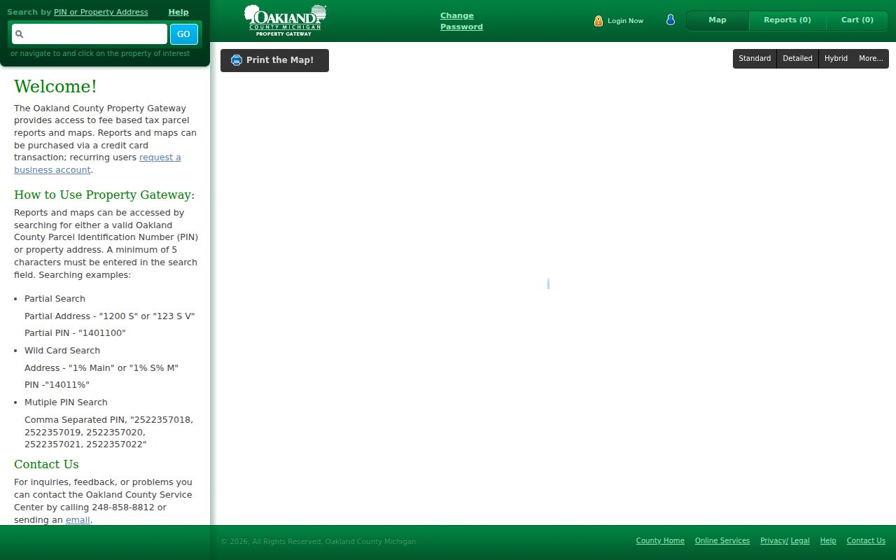
Partial examples documented by the county include 1200 S, 123 S V, 1% Main, and 14011%. Save the exact result before moving to another source because municipal update practices and field classifications can differ.
Map Parcels Along Novi Streets
A PIN is Oakland County's unique ten-digit parcel identifier, also called a Parcel ID or Sidwell number. It bridges the street address to the map and land-record attributes. In the map, select the target parcel, note its KeyPIN, then pan or zoom along the road to compare nearby features. The City of Novi Map Gallery supplies city tax-parcel, street, zoning, flood, school, public-safety, cemetery, voting-precinct, land-value, and sales layers.
Oakland County's parcel feature layer identifies KeyPIN as the parcel-to-record bridge.
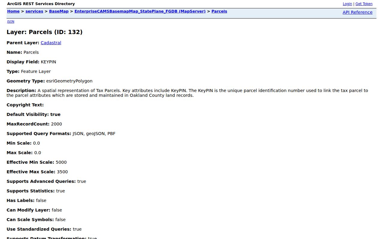
Parcel edges and road geometry help organize a street search, but a displayed boundary is not a legal survey and it does not identify everyone in a structure. Use the map to identify land units, then check the appropriate recorded or dated source for the question at hand.
Novi Street Deed Chain
After an address produces a PIN and legal-description clues, search the Oakland County Super Index. Its advanced fields include Grantor/Grantee, Recorded/File Date, Instrument Number, Document Type, Subdivision, and Block and Lot. Search the current owner as a grantee, identify the earlier grantor on the resulting instrument, and then search that party as a grantee in an earlier period. Compare the legal description at every turn.
Index work is free, while document detail, images, or downloads can require payment. Record the instrument number, date, parties, type, subdivision, lot or block, and legal description before deciding whether to obtain an image. County documentation supports recorded-document copies back to January 1, 1964, except subdivision plat maps. Older deeds, books, and microfilm can require the county office, FamilySearch's Oakland catalog, the Archives of Michigan, historical collections, or the Novi Library.
Search an earlier street name and the subdivision or lot/block when an address gives no result. A purchaser, seller, trustee, heir, or mailing addressee is a party to a land record. A separate dated source is needed before calling that person a resident of the street.
Novi Permit Records by Street
Novi Community Development handles building permits, inspections, code compliance, land use, and zoning. A permit or inspection record can establish a project chronology and may name an applicant, contractor, or owner as recorded. It does not establish that the named person lived at the address. The department is at 45175 Ten Mile Rd and can be reached at 248-347-0415.
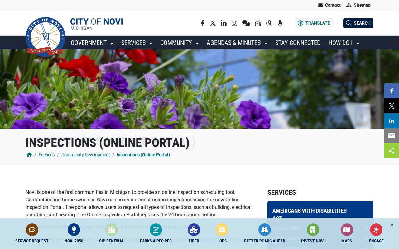
The city's inspection instructions describe building, electrical, plumbing, and heating inspection requests. They require an assigned permit number and set a 3:30 p.m. cutoff for next-business-day submission. A person without internet access is directed to contact the department. BS&A View My Activity requires an account and an assigned PIN, and no open citywide permit or code-results table was verified.
Novi's permit-instruction page shows the address-specific inspection route.
For a defined address, date range, and record type, submit a narrowly drawn request through the Novi FOIA Request Center. Michigan's Freedom of Information Act, MCL 15.231 et seq., governs public-record requests; city-held records should be requested from the city rather than assumed to be part of the county deed index.
Novi Street Names Across Records
The city's master street-name list is the local crosswalk for Building, Assessing, CLEMIS, LAMS, QVF, GIS, USPS, and original-plat names. Pair it with the 2026 Novi street map before deciding a search failed. The map has a street-name index, adjoining roads, major and private roads, landmarks, rail lines, schools, cemeteries, streams, lakes, and building footprints. It establishes spelling and map context, not parcel ownership.
Search both forms of a changed street. The list records Lee BeGole and Lee Begole, Monday Drive and former Avery Lane, Ludlow Street and Drive, Millstream and Mill-Stream, plus Main Street variants. Decker Road became Novi Road in 1996. West Road became West Park Drive in 1999, and the city noted that tax records could retain the old address. In 2012, Sheraton Drive became South Karevich Drive and Karevich Drive became North Karevich Drive.
That local geography explains many address mismatches. Preserve the old and new form with its source date, then use the PIN, lot/block, or legal description to test whether the two descriptions point to the same land.
Novi Street Records by Address
Address-keyed sources reveal different relationships. Start with the property card for land and tax labels, the map for parcel context, and the recorder for a transfer trail. Permit, voter, and directory material can add dated evidence, but none creates a complete household list for a street.
| Address record | Search key | What it can establish | Important limit |
|---|---|---|---|
| Tax or assessing card | Address, PIN, or related name system | Owner, mailing and situs labels, values, exemptions | An owner is not automatically an occupant |
| GIS parcel | PIN or parcel click | KeyPIN, adjacent land, and map layers | A map boundary is not a survey or household list |
| Deed index | Grantor/grantee, date, type, subdivision, lot/block | Recorded parties and legal description | Index and image access have a 1964 copy-coverage nuance |
| City permit | Permit, PIN, or address | Project and inspection chronology, named participants | Account/PIN or FOIA route; no open streetwide index verified |
| Michigan QVF | Name, address, jurisdiction, or defined file scope | Allowed voter address, status, and history fields | Protected fields and no household census |
| Directory street index | Street, number, and year | Dated occupant or householder notation | Coverage and geography vary by volume |
| USPS | Street, city, state, and ZIP | Postal delivery validation | It does not prove a person is at the address |
Use the PIN as the stable connector, and use the street name as the readable label. The same owner may have a mailing address elsewhere, while one parcel can have several owners or a tax recipient such as an agent or trustee.
Novi Street Record Terms
Land and directory records use terms that look alike but identify different things. Keeping their meanings straight is especially important when a street was renamed or a document uses a plat rather than the modern address.
- Parcel
- A defined piece of land on the county map, identified in Oakland County by a ten-digit PIN or KeyPIN.
- Situs address
- The physical location of the parcel. It may differ from the mailing address used for tax or notice delivery.
- Plat
- A recorded subdivision map that can connect a lot and block to a road layout. Older plats can require a recorder or archive route.
- Criss-cross directory
- A directory arranged by street and house number rather than by surname, used to find a dated address entry.
A legal description is the recorded land identity, often expressed through subdivision, lot, block, metes, and bounds. It is the best comparison point when the street form changed over time.
Novi Voter and Directory Evidence
Michigan's QVF has a statewide street-address index for city or township and precinct work. The public Michigan Voter Information Center is not a way to export everyone on a street. For an authorized, defined request, the state form can include complete name, residential and mailing address when available, birth year, registration date, status, voter ID, voter history, and district codes. It withholds driver-license and state-ID data, full birth date, phone, email, signature, and other protected fields.
Use the Michigan Voter Information Center for its limited public function. A fuller QVF request is scoped by state, county, jurisdiction, district, school, village, ward, or precinct, not as a general street roster. The request form provides pickup, encrypted-flash-drive CSV, FTP, or mail delivery routes and identifies MDOS-FOIA@Michigan.gov and the Bureau of Elections in Lansing for submission. Protected voters and Address Confidentiality Program participants must never be reverse-engineered.
For older address evidence, the Novi Local History Room, Oakland historical collections, archives, and dated directories provide a better fallback than trying to turn a current voter record into a past household history.
Novi Street Records Access Routes
Online search is only one route. Property Gateway and the map gallery handle parcel context; Super Index handles recorded-document index work; Community Development handles its permit workflows; and the city FOIA center handles a defined city-held record request. When a document predates online coverage or a plat is missing, use the county counter, library, archive, or catalog route rather than guessing from a modern address label.
Oakland Land Records
Oakland County Clerk/Register of Deeds, 1200 N. Telegraph Road, Department 480, Pontiac, MI 48341. Phone: 248-858-0597. The office retains the counter route for recorded-land material beyond the online index.
Novi Community Development
45175 Ten Mile Rd, Novi, MI. Phone: 248-347-0415. Ask about an address-specific permit, inspection, zoning, or code record and its available access path.
Note: A narrow request that names the address, date range, and record type is easier for a custodian to locate and review.
Limits of a Novi Street Directory
A street search cannot provide a complete census of every household. Private utility and delivery accounts, protected-voter addresses, DMV addresses, sealed-court participants, and private association rosters are outside ordinary public street research. Even a parcel map shows land units, not every person connected to an address. A negative result can mean the source uses an earlier street form, a different legal description, or a record type that was never public.
Lawful use. Novi address records are for personal, lawful research and civic understanding. Do not use them to stalk, harass, intimidate, or harm any person, and do not attempt to uncover protected addresses.