
Novi ZIP Code Coverage
City and state map material provides a careful baseline for Novi postal geography. The City of Novi ZIP map labels four ZIP areas in the Novi area. Michigan's official map identifies 48374, 48375, and 48377 as Novi labels. These are postal service areas, not neighborhood borders or city-limit lines, so the table uses only the level of geographic detail the research supports.
| ZIP | Areas Covered | Post Office | Notes |
|---|---|---|---|
| 48167 | Northwestern Novi and the Northville-edge area shown on the city ZIP map | Northville postal label | City and postal edges can differ; validate the exact street with USPS and the city map |
| 48374 | Novi area labeled on city and state maps | Novi label/route | A common Novi search label, not a legal city-limit boundary |
| 48375 | Novi area labeled on city and state maps | Novi label/route | Exact neighborhood boundary was not published in the inspected sources |
| 48377 | Novi area labeled on city and state maps | Novi or annex route context | Do not infer a subdivision from the ZIP alone |
The city map's 48167 Northville-edge label needs extra care. An address near that edge can carry a Northville postal label while its municipal or parcel context needs separate confirmation. The three 48374, 48375, and 48377 labels are the core mapped Novi baseline, but every street still needs address-level USPS validation.
Verify a Novi ZIP Code With USPS
USPS ZIP Code Lookup is the verification layer for a complete address. Its result helps confirm postal delivery formatting before a map or property search. USPS expressly warns that a ZIP lookup does not prove a particular person or company is at the address, so use it for postal validation only.
| USPS lookup mode | Fields | Required inputs | Result use |
|---|---|---|---|
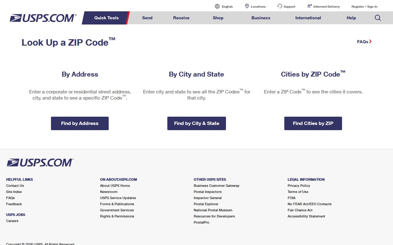
| ZIP Code by Address | Street Address, City, State, Company, Apartment/Suite | Street Address, City, and State | Checks the ZIP for a complete delivery address |
| ZIP Code by City and State | City and State | City and State | Finds ZIP choices for a recognized postal city name |
| Cities by ZIP Code | ZIP | ZIP | Returns postal city labels associated with that code |
The USPS lookup screen provides the address, city-and-state, and ZIP-driven modes used for postal confirmation.
Use the postal city name USPS recognizes. If the result differs from a familiar local label, preserve the returned form and then check the relevant city, county, or parcel source rather than forcing the address into a preferred ZIP label.
Search Records by Novi ZIP
A ZIP code is a grouping label, not a stable county property-search filter or a public resident roster. No stable assessor ZIP-filter screen was located for Novi, and Michigan's QVF request form scopes data by jurisdiction, district, school, village, ward, or precinct rather than a simple ZIP export. Use a verified address to enter the appropriate record system instead of promising a ZIP-wide result that the portal does not provide.
- Run the full street address through USPS and retain the postal city, state, ZIP, and any ZIP+4 returned.
- Check the Novi Map Gallery or Oakland mapping tools to identify the municipality, parcel context, precinct, and street spelling.
- Search Oakland County Property Gateway by the address or PIN, not by an assumed ZIP-wide parcel filter.
- For voter information, use the Michigan Voter Information Center's limited public function or make a lawful, defined QVF request within its stated jurisdictional scope.
- Once the address is narrow enough, use the Novi street directory for the parcel, deed, permit, and historical street-record chain.
Historical sources can use a township or post-office label rather than a modern ZIP. Pair an older address with the street-name list, a plat or legal description, and the applicable census geography. Do not attach a current ZIP to a nineteenth-century address merely to make it look familiar.
Novi ZIP Codes and City Limits
ZIP Code boundaries are postal geography. City limits are municipal geography. A street may use a Novi postal label and sit in an adjoining jurisdiction, while a location within a city limit may use a nearby postal city or code. Around Novi, the 48167 Northville-edge label is a clear reason to confirm the exact street rather than treating the ZIP as the city answer.
When the postal result and a local map appear to disagree, do not assume either one is wrong. Use USPS for delivery format, use the city map for city context, and use the county parcel record for the land unit. A school boundary, voting precinct, flood layer, public-safety map point, or cemetery layer has its own purpose and is not a substitute for a ZIP or municipal boundary.
At a Novi edge, preserve three separate values: the USPS delivery result, the city-map location, and the county parcel's ten-digit PIN or KeyPIN. The PIN is the stable bridge to the property and land record. A parcel's situs is its physical location, while its tax mailing address is where notices go. Neither a mailing label nor a postal ZIP should replace the parcel record when identifying which municipality holds a local record.
Postal versus legal geography. A Novi ZIP Code identifies a delivery label, while the PIN and parcel map identify a land record. Keep both values when they differ.
Novi 48376 and 48393 Labels
USPS postal-bulletin material shows routing or label relationships involving 48376 and 48393. The research did not verify either one as an ordinary, citywide Novi street-delivery ZIP. Treat them as address-specific, routing, or legacy aliases only when USPS validates the exact address. Their current unique, PO Box, or service-area roles were not fully verified in the inspected source material.
That restraint matters when comparing old directories, maps, or family papers. A postal label can be useful evidence of how mail was routed at a point in time, but it is not enough to declare the location a general Novi ZIP area or to draw a boundary that the source does not publish.
Novi Maps Behind Postal Labels
The 2026 Novi street map adds a street-name index, roads adjoining Novi, rail lines, building footprints, schools, cemeteries, streams, lakes, and landmarks. It is the useful local companion to a postal lookup. Use it to check a road name and visible context before locating the property in the parcel system.
For record continuity, the city's master street-name list reconciles Building, Assessing, CLEMIS, LAMS, QVF, GIS, USPS, and original-plat names. A postal label does not erase an older street form. Decker Road became Novi Road in 1996, West Road became West Park Drive in 1999, and the 2012 changes split Sheraton and Karevich forms into South and North Karevich names. The PIN, lot/block, or legal description is the safer bridge across those changes.
The city map does not establish a citywide quadrant numbering convention or exact neighborhood ZIP cuts. The master list is an addressing bridge, not proof that every historic record was automatically reindexed.
Novi ZIP Code Terms
Postal terms describe delivery organization, not property ownership or resident status. They are useful when copied exactly from the tool that returned them, particularly at city edges and when an apartment or suite is part of the address.
- ZIP Code and ZIP+4
- A ZIP Code directs mail to a general delivery area. ZIP+4 adds a smaller delivery segment for a more precise postal address.
- PO Box ZIP
- A code used for post-office-box delivery. It should not be assumed to identify ordinary street delivery without an exact USPS result.
- Unique ZIP
- A postal code assigned for a particular organization or use. The research did not verify 48376 or 48393 as a current general Novi street ZIP.
- Carrier route
- A delivery sequence used by USPS. It is a mail-routing tool, not a municipal line or evidence of a household.
Company and Apartment/Suite are optional fields in the USPS address mode, while Street Address, City, and State are required. Include the unit information when it is part of the known mailing address so the postal check matches the delivery point.
Novi ZIP Code Record Limits
A ZIP search returns whatever that system indexes: a postal address, a registry match, or a routing label. It does not return all people connected to an area. Property Gateway and the Map Gallery are most naturally address, PIN, and parcel tools. The QVF is not a public ZIP list, and its public and request channels withhold protected information including driver-license and state-ID data, full birth date, phone, email, and signature.
Michigan FOIA, MCL 15.231 et seq., provides a route to request public records subject to exemptions. For a city-held, defined Novi record, use the Novi FOIA Request Center. For a county parcel or land record, use the county portal or the proper county custodian. A lawful QVF request can use pickup, encrypted-flash-drive CSV, FTP, or mail delivery and goes to MDOS-FOIA@Michigan.gov or the Bureau of Elections in Lansing. Limit every request by address, date range, and record type rather than treating a ZIP Code as a request for a population list.
Novi ZIP Code Access Routes
Postal validation starts online with USPS. City maps provide the local geography, county parcel tools supply the address-to-PIN bridge, and the relevant custodian holds the record behind a specific address. Novi Community Development at 45175 Ten Mile Rd, 248-347-0415, is the city route for address-specific permits, inspections, land use, zoning, and related requests. Older local work may need the Novi Library, county historical collections, or an archive because historical directories did not use modern ZIP labels.
Note: Preserve the date of the map or postal result because routing labels, city boundaries, and record interfaces can change independently.